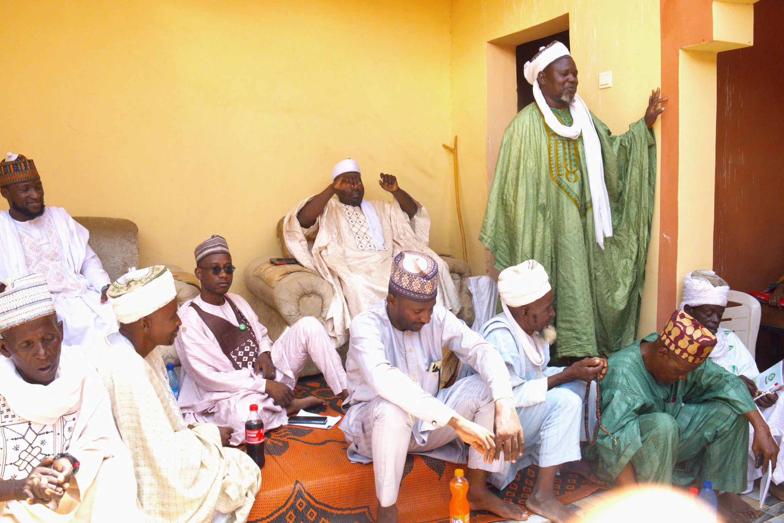
Blog — eHealth Africa - Building stronger health systems in Africa

Project GRID: Mapping Communities in Nigeria to Aid Humanitarian Efforts

By Daniel Ojabo

A vast number of the most vulnerable human settlements in Africa have remained unmapped. In the case of a public health emergency, knowing where people live, the best ways to get in and out, and the locations of basic necessities such as hospitals are of paramount importance.

The paucity of accurate geospatial data, including population settlement data, presents a major obstacle to adequate decision-making across Nigeria and remains a barrier to development. The Nigeria GRID (Geospatial Reference Information Database) project is part of a bigger global initiative; a multi-country, multi-donor initiative that aims to collect and store geospatial data across several African countries.

The GRID project will complete the mapping of the remaining 25 states plus the FCT. 

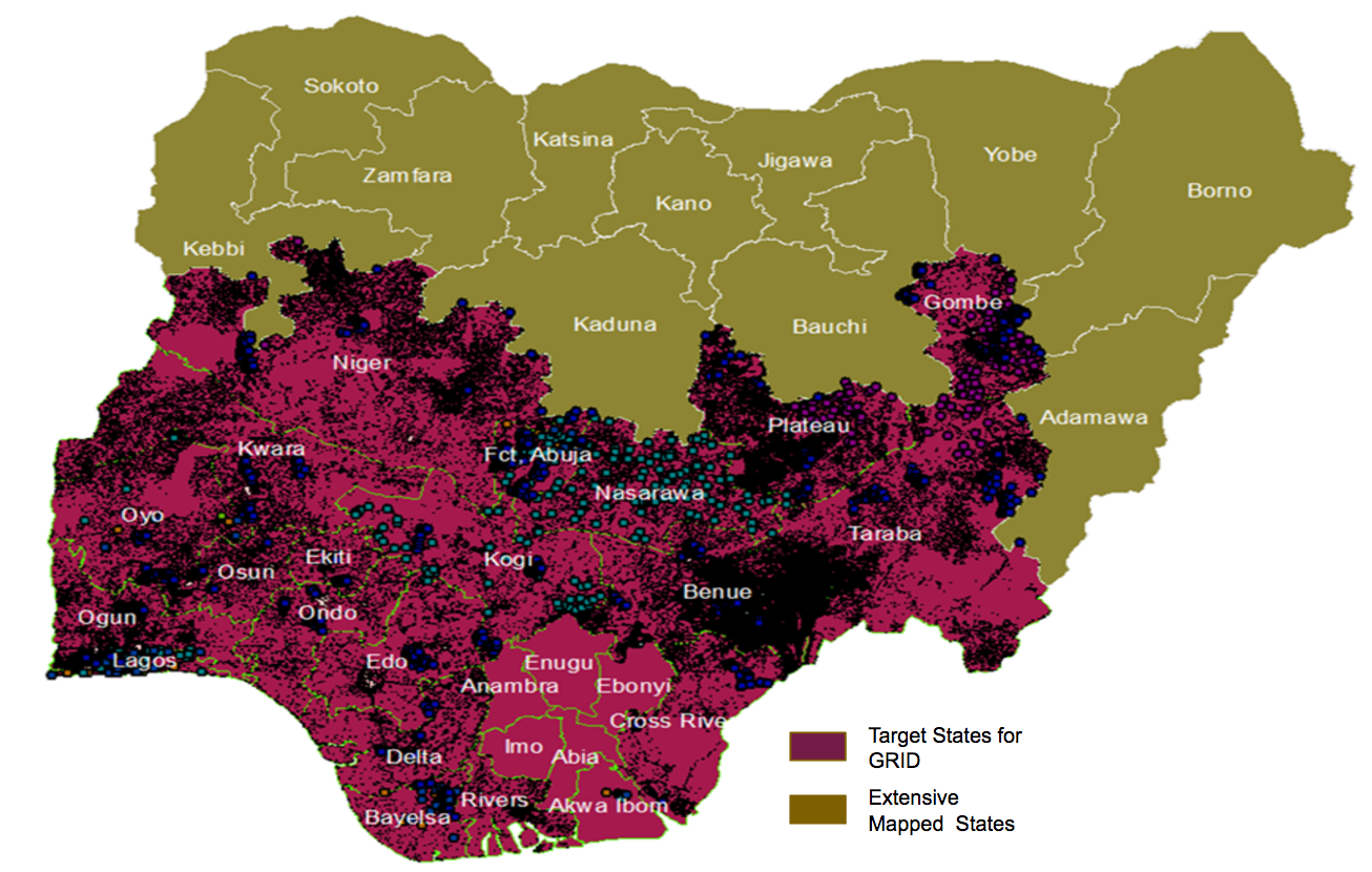
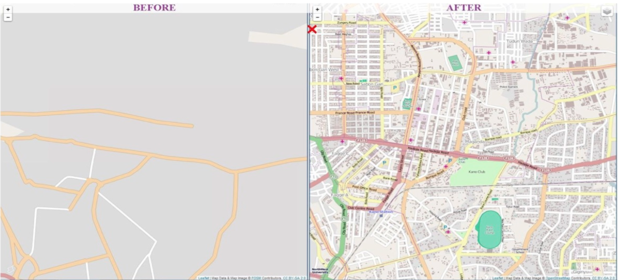
Through the Global Polio Eradication Initiative (GPEI) in Nigeria, the Bill and Melinda Gates Foundation (BMGF) via eHealth Africa (eHA) has mapped 11 out of 36 states and the Federal Capital Territory (FCT) of Nigeria. Through the GPEI, eHA deployed a combination of remote sensing satellite imagery, primary data collection, and geographic information systems to map over 140,000 settlements and other relevant points of Interests (POIs). The GRID project is now scaling up to the whole country and will complete the mapping of the remaining 25 states plus the FCT, collecting settlement names, geographic coordinates, and POIs such as health facilities, schools, and markets across the country.

Several attempts have been made to provide reliable geospatial data to the country. But despite this, there still exist significant gaps to be addressed regarding the quality, completeness, and sustainability of geospatial data available across Nigeria. In addition, there is a lack of capacity within the state and the federal government to leverage existing infrastructure to develop robust systems which can collate, manage, and enhance existing geospatial data. The capacity to develop innovative tools to effectively exploit geospatial data which can support improved decisions, policies and socio-economic resilience is also limited.

eHA's contribution to the OpenStreetMap (OSM) platform. Before and after ... Kano State, Nigeria now has a free digital map to help tackle public health emergencies.

The GRID project aims to bridge this gap, by supporting state and federal government agencies to strengthen geospatial data availability across Nigeria. To do this, the project will adopt the same methodology used during the GPEI to map and provide geospatial data for the rest of the country. Over a period of 9 months, the GRID project will develop a geodatabase of settlements with GIS coordinates, population estimates, and other relevant POIs across 25 states and the FCT. The project will also build the capacity of the Nigerian government to utilize the data effectively.

eHA remains committed to the development of people-centric and data-driven technology solutions that connect and deliver better public health services for vulnerable communities in Africa. See more stories and articles about eHA's innovative work by signing up for our monthly newsletter.


The DHIS2 Experts Academy 2017 - Pushing the Frontiers of Dynamic Health Information Systems

By Hawa Kombian

DHIS2 Experts Academy participants. Photograph courtesy Kjerstin Andreasen

eHealth Africa (eHA) participated in the DHIS2 Experts Academy Conference in Oslo, Norway in August of 2017. eHA’s Les de Wit (Software Project Manager) and Jasper Timm (Lead Software Developer) supported the conference’s focus on sharing the most exciting innovations and uses of DHIS2.

District Health Information Software 2 (DHIS2) is an open source health information platform used in 60 countries. eHA and its partners use DHIS2 in key public health projects to enable Ministries of Health to maximize the health of their citizens. DHIS2 enables users to store and track health data, analyze it to understand trends and patterns and develop evidence-based execution strategies that will deliver impact for communities.

Pictured top left and right: Les de Wit and Jasper Timm. Photograph courtesy of Kjerstin Andreasen

The DHIS2 Experts Academy Conference was a gathering of 170 DHIS2 users, implementers, and developers from government, academia, and non-government organizations (NGOs). Jasper Timm and Les de Wit delivered a presentation entitled “Offline apps for disease surveillance from eHealth Africa in Sierra Leone [1, 2] and Liberia” which highlights eHA’s work in electronic integrated disease surveillance (eIDSR). To reduce the frequency of the errors, which are prevalent in paper-based reporting and during the process of transferring data from one platform to another, eHA in collaboration with the Center for Disease Control and Prevention (CDC), World Health Organization (WHO), and additional partners developed a mobile eIDSR application. This eIDSR app enables the entire health system to accurately record and share community-level health information from the district level to the national level.

During the event, the DHIS2 roadmap was discussed as well as workshops on new and upcoming platform features. There were also sessions on the software’s best practices and demos highlighting use cases of DHIS2 implementation from around the world. The opportunity to connect with colleagues integrating information and technology in health aligns directly with eHA’s respective vision and mission; to establish new standards in technology and provide underserved communities with tools to lead healthier lives. Join our team today and work on innovative tools and platforms that impact public health!