GIS

Tackling Nigeria's Zero Dose Challenge: The Final Push with Geospatial Tracking

By Nnenna Ohiaeri

Introduction

In 2020, Nigeria was declared wild polio-free after meeting the requirements to attain the status, which includes 3 years without any new cases of wild poliovirus in the country1. Prior to achieving this milestone, Nigeria was one of only three countries in the wild with endemic wild polio. GIS (Geographic Information System) tracking was first implemented in Nigeria’s Polio program in 2012 with eHA’s Vaccination Tracking project (VTS). VTS was decommissioned in 2020, just after Nigeria was declared Polio free. 

Our Intervention

Since 2022, eHA has been providing GIS tracking support to the polio outbreak campaigns in security-compromised locations with the Polio Special Intervention project, which is part of a key focus area of eHA - Public Health Emergency Response Systems. The purpose of this project is to support the efforts to improve the Polio outbreak response in Nigeria, with a focus on circulating variant poliovirus type 2, cVPV2, using the new Geospatial Tracking System (GTS) application to track vaccination teams. 

“Special Intervention”, in this context, refers to the security-compromised nature of the implementing states. Due to banditry, kidnapping, and terrorism, several settlements in these states are either inaccessible or partially accessible. Vaccine-eligible children residing in these areas are denied access to their necessary vaccinations such as the Polio vaccine due to the insecurity posed by these activities. Accessing these communities means reaching the missed children and protecting the communities from disease outbreaks and securing a truly polio-free Nigeria. The project is being implemented in 57 local government areas (LGAs) with security-compromised settlements, in 7 priority states- Kaduna, Katsina, Kebbi, Niger, Sokoto, Yobe, and Zamfara. 

Geospatial Tracking System (GTS) was introduced by Novel-T after the decommissioning of the VTS application. The GTS application is a “lightweight” version of the VTS and was first piloted in Borno State in 2020 and is currently being used on this Polio Special Intervention project.

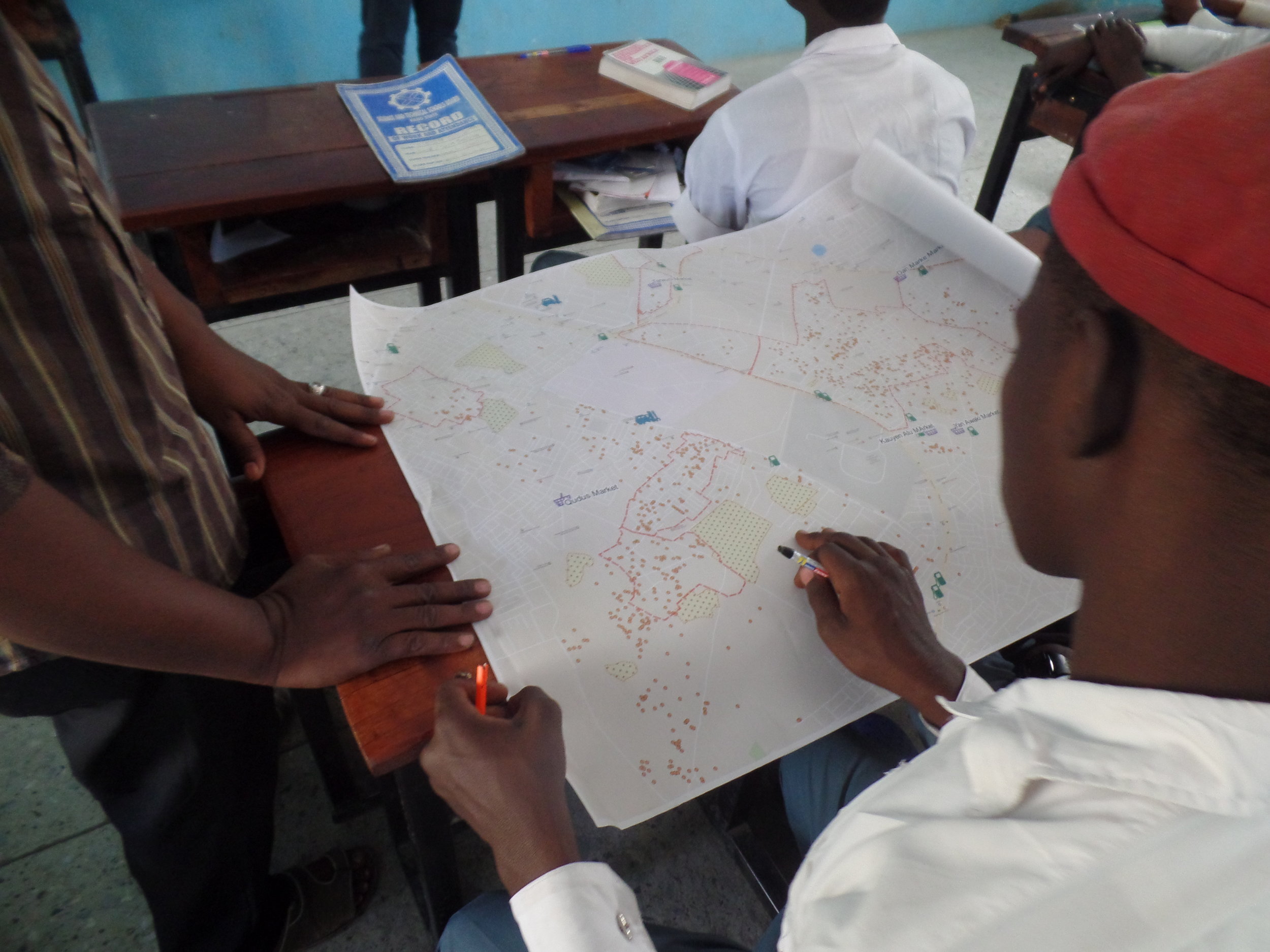
The GTS application is used to monitor vaccination teams and report daily missed settlements based on the DIPs (daily implementation plans) of a campaign. The process flow is displayed below:

Results

Since the inception of the project, the eHA-led activity has had a significant impact on the polio campaign implementation. Between September 2022 to May 2023, eHA has supported 66 LGAs with GIS tracking across the 7 implementing states. 3,953 settlements with vaccine-eligible children have been verified to have been visited by the vaccination teams during 2 rounds of polio campaign implementation in the states, using GTS trackers, and 1,664 vaccination teams were tracked during the campaigns. 

Field technical teams were deployed to each implementing LGA to support the campaign. 66 LGA consultants were trained on the administration and operation of the GTS application.  The consultants built the capacity of the LGA team on GIS tracking with trainings on GTS and the handling of the trackers. This was necessary to make sure that the vaccination teams are fully equipped and knowledgeable enough to successfully implement GIS tracking during the campaigns. Data collection activities were also conducted during the campaigns to obtain the geo-coordinates of settlements that are not on the Polio geodatabase (GDB). 69 data collectors were trained on the use of the KoboCollect application to collect geo-coordinate data in the field. This data collection ensured that the visitation of the planned settlements by the vaccination teams could be verified.

Conclusion

GIS tracking has helped increase vaccination coverage throughout the 7 priority states where it was implemented. In addition to increased coverage, GIS tracking also provided data-driven insights for decision-making. It increases the quality of campaign implementation and improves accountability, by validating the tally sheet reports generated by the vaccination teams. GIS tracking can be utilized beyond polio programming to support other vaccination initiatives by improving vaccination coverage and in turn, boosting Nigeria’s immunization indices.

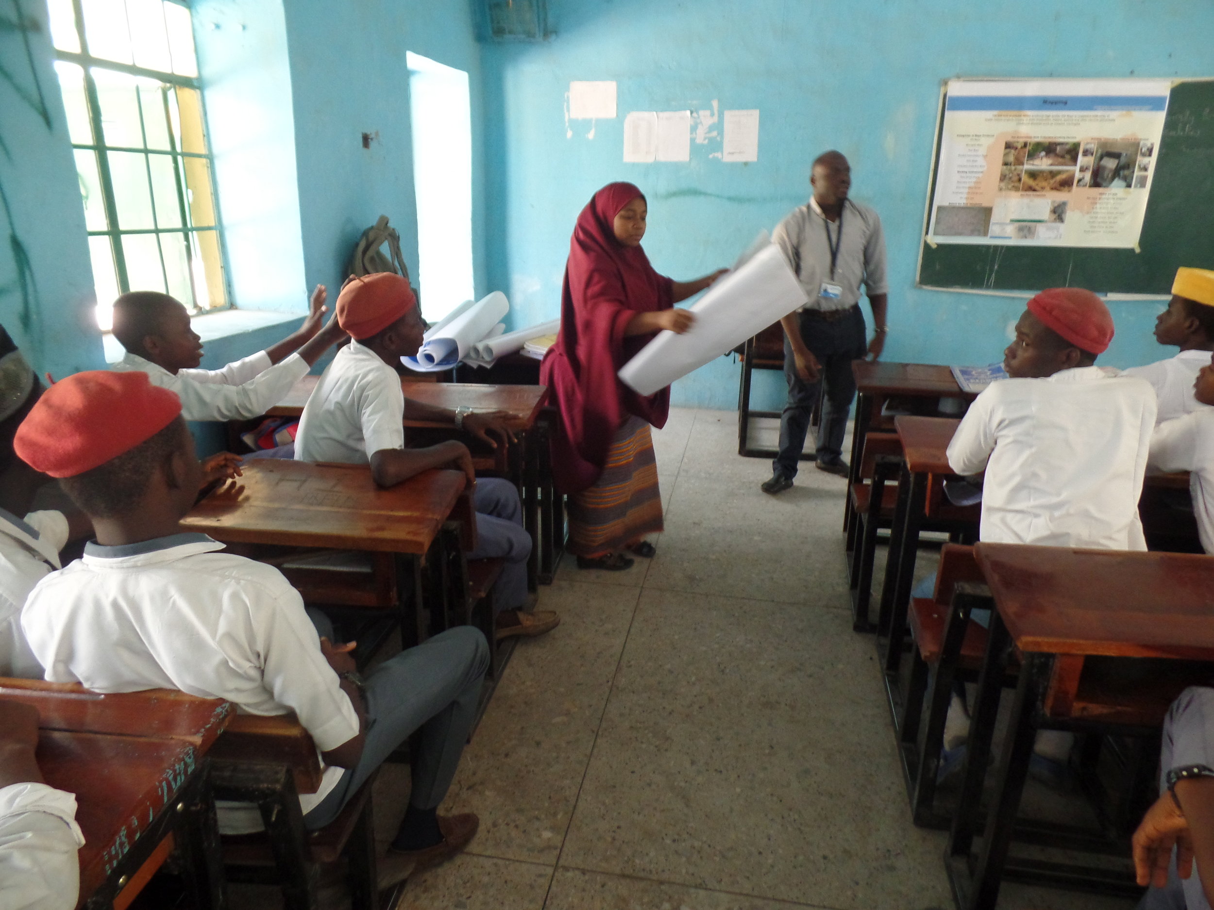
Training of LGA team in Rijau LGA of Niger state on the GTS application and handling of the trackers

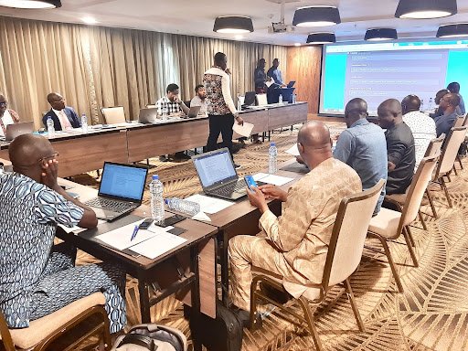
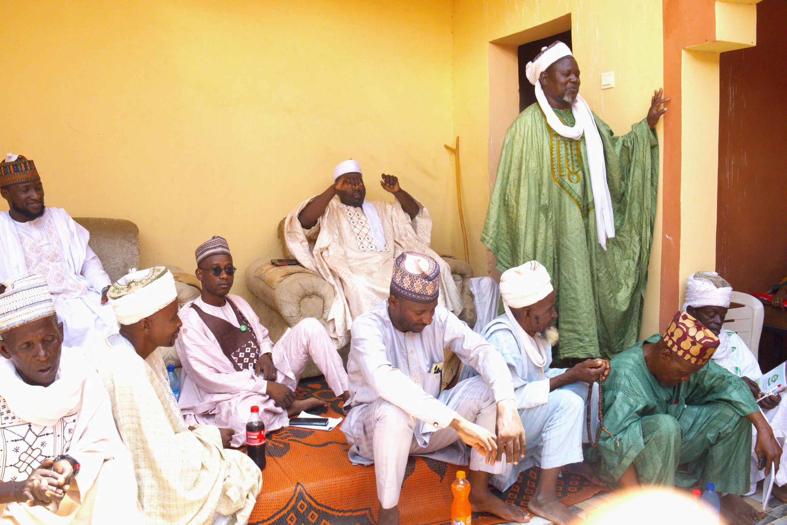
Engagement meeting with the Niger State Primary Health Care Development Agency team 

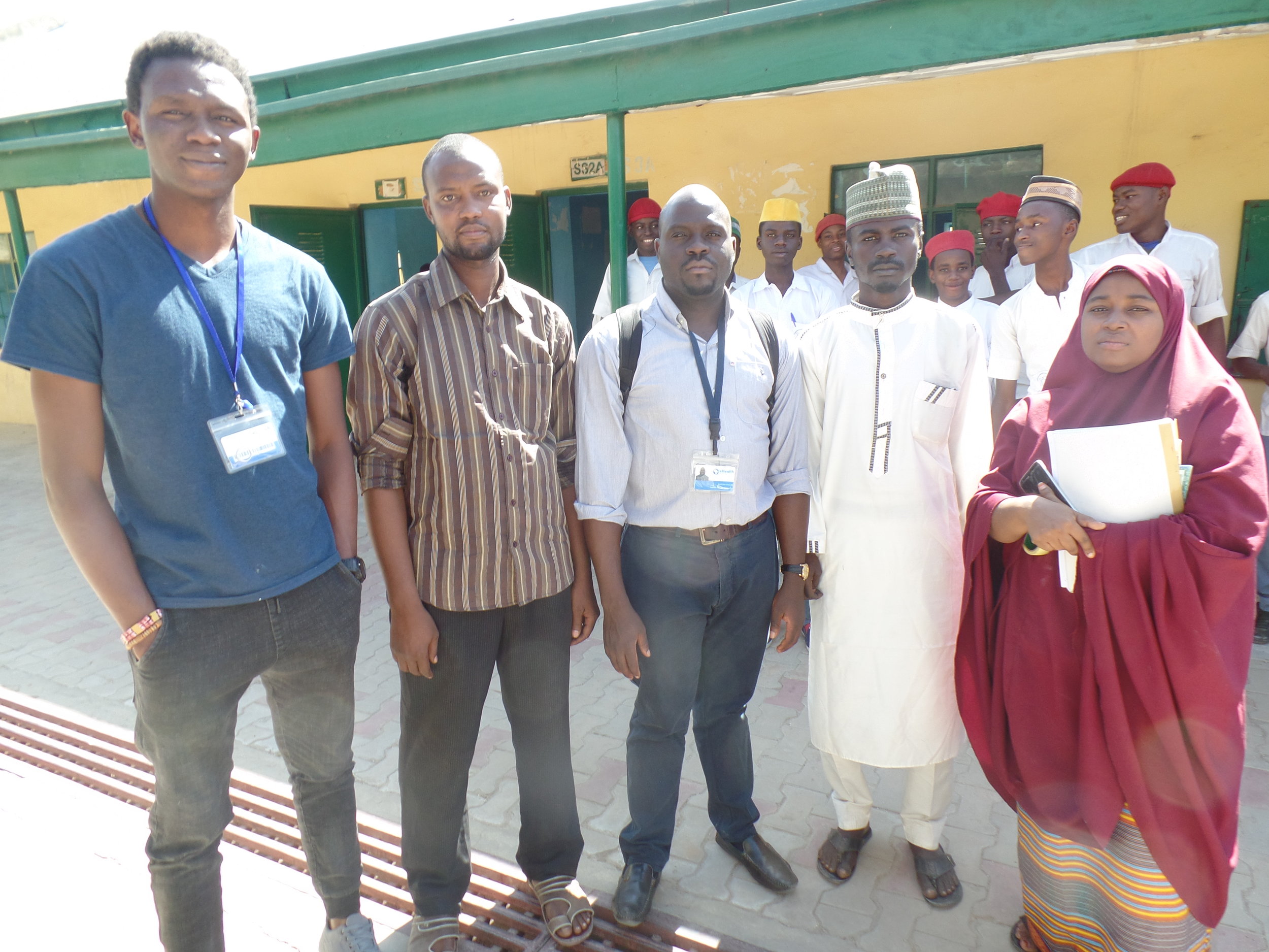
L-R : Basheerdeen Abdullahi (eHA State Coordinator), Mohammed Alhaji Usman (State Health Educator), Abubakar Shehu (Program Manager, eHA), Kpantus Abubakar (State Immunization Officer), and Nnenna Ohiaeri (Project Manager, eHA)

How eHealth Africa is implementing the Geolocation Health Facilities Database Initiative (GHFDi) Project in the Republic of Togo

By Friday Daniel, Chinedu Anarado and Munachi Okoro


The public health space has relied on platforms from multilateral agencies and nonprofits to plan interventions. Platforms such as the Humanitarian OpenStreetMap, the WHO Integrated Supportive Supervision (ISS), and electronic surveillance (e-SURV) database, GRID3, and the Global Health mapping platforms were some of the only sources of information on health facility data. But these data sources can be inadequate, rarely reflect the realities on the ground and do not have the imprimatur of relevant government authorities. Equally, Ministries of Health in most WHO countries lack the capacity to curate and manage their health facility data, leaving a critical information gap in the health planning process. 


The WHO conceived the Geolocated Health Facility Data initiative (GHFDi) project as a public good to enhance access to information on the status, location and functionality of health facilities across participating WHO member countries. The overall idea is to deepen capacities in each country to manage this data, ensure its openness and availability in planning public health interventions. 


The GHFD project requires participating countries to grow their capacity to curate and manage their health facility data. But first, an assessment of the existing health facility list or registry is essential. This is expected to provide insight into the efforts required to achieve an ideal scenario which is a database of health facility information, with name, location, unique identifier, geographic coordinates and hosted in an open source platform. Countries may then choose to share this information with a global database managed by the WHO, and then invest in an ongoing process to grow their capacity to ensure the information is updated periodically. 


eHealth Africa is one of the implementing partners of the AFRO region responsible for implementing this project in the Republic of Togo. On the 9th of August 2022, an introductory meeting was held at the headquarters of the Ministry of Health in Togo. This meeting was organized by eHealth Africa in partnership with the Ministry of Health and the WHO country office. 


It brought together various stakeholders responsible for establishing and updating the health facilities database in Togo, including the Ministry of Health (MSPAUS), the National Institute of Statistics and Studies and Demographics (INSEED), as well as the delegate ministry in charge of Territorial Development.

Landscape assessment and data collection session during the workshop in Togo

With an introduction by Dr. Ouedraogo Romain Hilaire, health systems coordinator at the WHO country office, Mr. Compaore Fabris, eHealth Africa representative in Togo and Chinedu Anarado, program manager, eHealth Africa, discussed with the participants on how GHFD seeks to strengthen the capacities of the Ministry of Health to guarantee the availability, quality, accessibility and use of a health facilities master list (HFML) in countries. 


This capacity building should enable the Republic of Togo to have a standardized database open to the public. Participants discussed the seven strategic pathways through which the GHFD initiative will strengthen the Ministry of Health, including governance and policies, partnerships and collaboration, technical capacities, innovation, financial sustainability, communication and advocacy, interoperability, and data management.This introductory meeting led to the conclusion and agreement to hold a participatory landscape analysis workshop on August 30th and September 2nd.


At the end of this workshop, it was discovered that Togo has a unit in charge of the health services mapping, who oversees the health facilities master list (HFML). The Ministry of Health in Togo appreciates the initiative and sees it as an opportunity to strengthen the government's efforts to ensure universal access to care.

Group photograph of the workshop participants

eHealth Africa has since implemented a landscape assessment and is currently developing a report and cost work plan that will itemize the efforts required to bring Togo to the ideal scenario. 


To learn more about the GHFD initiative: https://www.who.int/data/GIS/GHFD 

eHealth Africa among winners in 2021 edition of the Wiki Loves Africa Photo Contest

2nd Place Winner Wiki Loves Africa Photo Contest 2021

2nd Place Winner Wiki Loves Africa Photo Contest 2021

Our submission to the Wiki Loves Africa 2021 Photographic Competition came 2nd place out of over 8000 entries.

Wiki In Africa, the international organizers of the Wiki Loves Africa challenges the global photographic community each year to respond to a call for photographs of life in Africa along a specific theme. This year, the competition called for photographers to contribute images that visually interrogated the theme of Health + Wellness within the African context but looking at the positive aspects within that sector of African life.

The image which emerged as a global winner was shot at the Kano head office of eHealth Africa during a Malaria Microscopy Training conducted by our Laboratory team. The image was uploaded by Dr. Nirmal Ravi who leads the team and was present during the session.

Need for Stable and Sustainable Energy for better Healthcare Delivery in Nigeria: A case study of Kano and Osun State Health facilities

By Mohammed Bello

A recent publication by International Renewable Energy Agency (IRENA) stated that around a billion people today rely on health facilities without electricity supply. While most large hospitals may have round-the-clock access to power, electrification rates drop significantly for rural clinics. In the absence of reliable power, many of the basic life-saving interventions cannot be undertaken safely or at all.

Also, a recent study analyzing over 121,000 health facilities, in 46 low and middle-income countries, found that almost 60% of them lacked access to reliable electricity. Even facilities with electricity access can often suffer from an unreliable supply – negatively affecting the ability of medical professionals in rural communities to deliver modern health services.

Renewable energy is at the forefront of solving this issue. Off-grid (stand-alone and mini-grid) renewable energy solutions represent a cost-effective, rapidly deployable, and reliable option to electrify healthcare centers, transforming lives whilst bolstering global efforts to achieve Sustainable Development Goal 3 – good health and wellbeing.

Lack of sufficient and reliable power is jeopardizing the well-being of millions of people, especially women and children, who often bear the brunt of inadequate primary healthcare services. In fact, worldwide, more than 289,000 women die every year from pregnancy- and childbirth-related complications, many of which could be averted with the provision of better lighting and other electricity-dependent medical services (Sustainable Energy For All, 2019).

Like the pilot Energy survey from 10 selected health facilities across seven (7) Local Government Areas (LGAs) of Kano state in August 2020, the expanded phase was also carried out by the Nigerian Energy Support Programme (NESP), a technical assistance programme co-funded by the European Union and the German Government and implemented by the Deutsche Gesellschaft für Internationale Zusammenarbeit (GIZ) GmbH in collaboration with the Federal Ministry of Power (FMP), in partnership with eHealth Africa. It was conducted in close cooperation with geospatial data experts from INTEGRATION Environment & Energy GmbH (INTee) and Reiner Lemoine Institut (RLI) in Germany. This is part of the effort of the NigeriaSE4ALL Initiative to offer the most up-to-date, ground-truth, electrification data available in Nigeria.

The expanded survey was also carried out using a remote interview method for conducting interviews with the health facility in-charges in selected health facilities across 43 out of 44 LGAs of Kano, and 27 out of 30 LGAs of Osun state.

The findings from the result of the earlier concluded pilot survey necessitated the expansion in the scope of the survey, to gather sufficient information that would help provide a bigger picture of the energy needs, current situation, and guidance for the planning of possible implementation of suitable energy solutions for communities. The expanded scope covered a total of 291 health facilities - 173 health facilities in Kano state and 118 health facilities in Osun state.


.

Helpdesk Agents administering questionnaires remotely to Health Facility In-charges in Kano and Osun State

Helpdesk Agents administering questionnaires remotely to Health Facility In-charges in Kano and Osun State

The methodology used in collecting the data is through remote administration of survey questionnaires via phone calls, to ensure adherence to and support the COVID-19 response efforts in Nigeria and minimize the risk of infection through physical contact.

The primary aim is to assess energy gaps and identify the potentials for connection to an off-grid power source (renewable energy) and at the same time, determine the readiness for Covid-19 response at the Primary Health facility level.

The diagram below presents a summary of the implementation approach adopted for the survey.

Figure:  Summary of the implementation approach adopted for the survey.

Figure: Summary of the implementation approach adopted for the survey.

  • The following four major data sources were utilized; 

    • list of health facilities extracted from the eHA data portal, 

    • Grid Clusters (potential location for off-grid infrastructure),

    • Senatorial administrative boundary

    • Contact list for Health Facility representatives

Health facility data and senatorial administrative boundaries were downloaded from the eHA Data portal/ GRID3 as shapefile format, power grid location was downloaded from Nigeria SE4ALL Webmap; in Geojson format, containing the KEDCO - Grid Data MV Lines (2016) and Osun state MV power lines. 

Finally, a structured survey was designed to capture the energy required capabilities and capacity of the health facilities.

Fig 2. Map showing the distribution of Primary health facilities in Osun state(Left) and Kano state(Right)

Fig 2. Map showing the distribution of Primary health facilities in Osun state(Left) and Kano state(Right)

Screenshot 2021-06-02 164425.png

Activities

Remote administration of questionnaires to the health facilities in-charges via phone calls to identify the following:

  • the health centers’ current electricity supply status

  • general services provided by the health centers, 

  • their current ability to cope with the COVID-19 response

  • available infrastructure at the health center that would impact considerations around power requirements

Key Findings

  • The survey findings indicate that all infrastructures do not meet up the minimal requirement stated by NPHCDA and some health services needed to be upgraded

  • Power shortages affect the functionality of many types of equipment at the health centers across all assessed facilities thereby, affecting the output and overall performance of the facilities in terms of service delivery.

Benefits of the survey

The outcome of the survey provides visibility on areas and health facilities that require urgent intervention, such as the provision of PPEs to the health facilities and other equipment/infrastructures. Also, the data collected were subsequently published with updated health facilities infrastructure and services information on the eHA data portal for public access and to all for non-commercial use.

Finally, the survey makes readily available information relating to health facilities and the preventive measures taken during the COVID-19 crisis.

Future Survey Use Case Potential:

The remote survey showcased the capacity to effectively gather information on energy sources and requirements whilst supporting efforts in preventing the spread of the COVID-19 virus, without requiring a face-to-face engagement. 

Considering the necessity for energy supply, especially at health facilities, these surveys present a clear understanding of current energy systems that may not be sustainable and the need to consider alternative sustainable energy systems that would have minimal impact on climate change and make lives better.

Ultimately, surveys can be conducted nationwide to establish a baseline for the energy requirements of Primary Healthcare facilities.

It is evident that the functionality and efficiency of the Nigerian health systems especially in rural settings, can not be optimized with the use of on-grid electricity, some components of which are affected by unstable weather due to climate change. As such, harnessing renewable energy will be an alternative way of addressing the persistent power challenges in the health sector.

The Program Partners

eHealth Africa’s Ifeanyi Franklin Ike, named one of the 50 rising stars in the geospatial Industry

By Oladipo O. Olurishe

Franklin, a GIS Coordinator here at eHealth Africa (eHA) has been recognized as a rising star to look out for in the geospatial industry the inaugural Geospatial World 50 Rising Star list published by Geospatial Media. We are excited to congratulate Ifeanyi Franklin Ike on this accomplishment. We had a brief chat with Ifeanyi about this accomplishment.

Ifeanyi Franklin Ike

Ifeanyi Franklin Ike

You were recently listed among the 50 rising stars to look out for in 2021 on the geospatial media, how does that make you feel?

This recognition comes as a bit of a surprise to me that out of all nominated young persons in the geospatial world, my contribution to the geospatial industry in Nigeria has been appreciated. It makes me feel excited and zealous to do even more. This could have come at no better time than now, when fatigue was already setting in for the work done for Nigeria’s COVID-19 response. I feel more energized to contribute more. 

Since last year, Ifeanyi has been working closely with the Nigeria Centre for Disease Control (NCDC)  to provide geospatial and data solutions to support the country’s response to the COVID-19 pandemic. He is a member of the multi-partner team that developed an assessment tool for checking health care workers' preparedness for COVID-19 response. Ifeanyi also designed the web and mobile geospatial analytics tools for tracking COVID-19 outbreak in the country. He also designed the data collection platform for the First Few Cases of COVID-19 (FFX) study in Nigeria and the dashboard for the COVID-19 Personal Protective Equipment (PPE) distribution in Nigeria.,

Can you tell us what geospatial data is and what the geospatial industry is all about?

In the first place, data is a set of information that has been translated into a form that can be processed. Geospatial data can then be said to represent the sets of data that are linked to specific/known locations in space (the world). 

Over the recent years, the geospatial industry has grown beyond imagination with potential for more growth. In our world of today, the application of location-intelligent (geospatial) algorithms in our daily engagements have developed drastically. So it is safe to say that the geospatial world is the backbone of most modern technological developments and will continue to do so in the unforeseeable future.

Can you tell us about your work, what you do around geospatial data?

I’m a data scientist with a special interest in geospatial data analysis, especially as it relates to the Global Health Informatics Strategy (GHIS). I employ insightful location-based analysis in creating solutions that help to support effective data-driven decision-making, especially in the public health sector. This passion for creating public health solutions using geospatial data was and remains my motivation for joining eHA.

What impact can you say your work has had by using geospatial data?

My work using geospatial data has positively impacted the Public Health space.  My use of geospatial data has supported the design of solutions that are geolocation-centric, bringing out varieties of insightful information which have supported public health decision-making across different organizations.

Some examples include contributing to the designing of the following tools:

  • eHA's PlanFeld application geodatabase

  • The vaccine delivery optimization tool for eHA

  • Sampling scripts for the National Micronutrient and Food Consumption survey in Nigeria

  • M&E tools for the tracking of World Bank COVID-19 grants to support IAP implementation in States

What is the future of geospatial data? How will it help the world solve problems?

As I mentioned earlier, geospatial data, geospatial technologies, and geospatial skillset forms the backbone of modern technological developments and will continue to do so in the next unforeseeable part of the future. With the global shift away from the era of the industrial revolution to the information age and the continuous increase in the need for location intelligent applications in our day-to-day endeavors, the future is very bright for the geospatial industry. I’m therefore excited to belong to the geospatial family of this generation and thankful to all my colleagues at eHA for the wonderful geospatial work we are doing together.

Let’s keep pushing. Thank you

Congratulations once again to Franklin,  continue the outstanding work you are doing in the geospatial industry.

Remote Data Collection as a First Step for Developing a Digital Information System to Guarantee the Supply of Quality-Assured Blood to the South African Population

By Dr. Alexander Pinz

The project    

The provision of safe and high-quality blood and blood products is a significant challenge for blood establishments in times of crisis. Depending on the crisis at stake, blood demand may suddenly explode, e.g. with mass casualty events; or there will be shortages in blood supply because of infectious diseases (epidemics, pandemics), and environmental catastrophes (e.g. floods, droughts). In these situations, it is important that blood establishments can rely on adequate information and emergency plans, enabling them to ensure the continuous supply of blood and blood products to both the entire population, and the persons severely hit by the crisis. However, currently, blood establishments are rarely included in national or regional emergency management plans. They often lack adequate information technology, enabling them to foresee slowly emerging crises or to react appropriately to catastrophic events that suddenly happen. According to the participants in the CoordinatedBlood-Workshop, which took place in Berlin in September 2018, these challenges apply to the South African blood supply system, too.

To better prepare blood establishments for crises, the BISKIT-consortium—comprising eHealth & Information Systems Africa, the Paul-Ehrlich-Institut (German Federal Institute for Vaccines and Biomedicines), and the Working Group Inter-disciplinary Security Research (Free University Berlin), the European Research Center for Information Systems (University of Münster), and the Chair for Software & Digital Business (Technical University of Darmstadt)—has started the project Blood Information System for Crisis Intervention and Management, funded by the German Federal Ministry of Education and Research. The aim of this research project is to improve the supply of safe and quality-assured blood and blood products before, during, and after a crisis to the South African population. To achieve this objective, the consortium is going to 

  • develop an information-system including a user-interface (demonstrator) for data-based decision-making, 

  • develop crisis management plans and recommendations for crisis communication, and

  • organize and implement capacity building training on the use of the demonstrator.

The challenge

To accomplish these objectives, we need an enormous amount of data. First, we have to map the South African blood transfusion as well as crisis management systems, including their major stakeholders. Second, we have to visualize the entire blood supply chain from vein to vein. Thus, we have to assess every single process step such as donor recruitment, donation, processing, and testing, transportation, and storage, as well as issuing of blood products. Also, we need GIS data on the locations of the relevant facilities like blood establishments, mobile clinics, hospitals, etc. Finally, we need quantitative data on the duration of each process step, the number of donors/donations, number of products, etc. However, due to the COVID-19 pandemic, we are not allowed to fly to South Africa to start our data collection process. So what can we do?

The solution

We exploited the digital tools available to us to start a virtual data collection process. Thus, we use video conference systems to implement key-informant interviews with relevant stakeholders of the South African blood transfusion and crisis management system. We store the data in a CKAN-portal that only members of the BISKIT consortium can access. To make the information obtained via these interviews available to the entire consortium, we transcribe the interviews with artificial intelligence software. We then analyze the anonymized transcripts with cloud-based as well as standard qualitative analysis software.

Having, so far, conducted 20 key informant interviews with persons responsible for different parts in the blood supply chain, and the crisis management system, we have t great insights into how the South African blood transfusion and crisis management systems work. We can use these insights to map the relevant actors and processes of the respective systems. In addition, we now have a notion of the different data available for upload. With this information, we start modeling the blood supply chain from a logistical perspective, and, thus, get the project started.

The world saw more video calls this year due to the COVID-19 pandemic.

The world saw more video calls this year due to the COVID-19 pandemic.

Sure, virtual data collection differs from data collection on-site. The social aspects of collaboration are missing. Nevertheless, in the interviews, we created a good atmosphere with the project partners in South Africa. Using video calls enabled us to at least see each other and get the relationship-building process started. This adaptation to the travel restrictions resulting from the COVID-19 pandemic has shown us we can collect data with digital technology. This approach enables us to better focus on the travels that are relevant for project success. It helps us to reduce our carbon footprint of development cooperation work. However, we are also looking forward to getting to know our project partners in person. Because in the end, this will further improve the quality of the data we can collect, and, thus, contribute to the aim of increasing the resilience of the South African blood supply system by using digital technology.

Dr. Alexander Pinz is the Project Manager for the Blood Information System for Crisis Intervention and Management (BISKIT) project at Paul-Ehrlich-Institut (PEI). PEI is the leading organization within the BISKIT consortium and responsible for coordinating the project implementation.

Remote Assessment of Energy Gaps in Selected Health Facilities in Kano State: Identifying Potential for Alternative Energy Sources

In accordance with the standard for operations in most health centers, The World Health Organization (WHO)1 states that the majority of health centers require energy for water supply, temperature control, lighting, ventilation, and clinical processes. In terms of electricity, Nigeria is ranked by the World Bank as the second country in the world and the first in Sub-Saharan Africa with more of her population not having access to electricity. With a population of about 200 million Nigerians, over 80 million representing 40% of the country’s population, lack access to grid electricity2. Presently, power generation, transmission, and distribution rates are not commensurate with the energy demands of the population, giving rise to consumers depending on dirty and outdated energy sources that have adverse health and economic consequences on them and the society at large. Nigeria’s energy demand was estimated to rise to 88,282MW by 2020 from 15,730MW in 20163 . Despite the country’s current installed generation capacity of 12,522MW, it generates an average of 4,500 MW, which is transmitted through its fragile National Grid and is grossly insufficient to meet the electricity demand of its 190 million population not excluding demands at health facilities.

Sadly, only an estimated 30% of Nigerians are connected to the national grid. This low and erratic power supply affects the community’s primary health centers forcing the management to rely on kerosene lanterns as a source of lighting and petrol generator as their primary source of electricity (UNDP Nigeria., 2015)4. As a result, this hinders the efficiency of health services and amenities for optimal operation.

To improve service delivery dependent on energy supply, there is a need to identify the gaps in energy sources of primary health centers in relation to needs/consumption. To this end, a pilot survey was carried out by Nigerian Energy Support Programme (NESP), a technical assistance programme co-funded by the European Union and the German Government and implemented by the Deutsche Gesellschaft fürInternationaleZusammenarbeit (GIZ) GmbH in collaboration with the Federal Ministry of Power (FMP), in partnership with eHealth Africa. It was conducted in close cooperation with geospatial data experts from INTEGRATION Environment & Energy GmbH (INTee) and Reiner Lemoine Institut (RLI) in Germany. This is in line with the objectives of the SE4ALL initiative that are working globally to ensure universal access to modern energy services; doubling the global rate of improvement in energy efficiency, and doubling the share of renewable energy in the global energy mix by 2030 compared to 2010.

Due to the current pandemic (COVID-19) situation of the world and the country Nigeria, the pilot was geared at finding out how effective remote surveys can be applied to gather data required to understand and make decisions on energy challenges at health facilities. It was pertinent to adhere to all precautionary measures to prevent the further spread of the virus during an actual physical face-to-face survey. Hence, this survey employs a remote data collection approach in administering questionnaires, as an alternative to the conventional physical data collection.

Helpdesk Agent administering questionnaires remotely to Health Facility In-charges in Kano State

Helpdesk Agent administering questionnaires remotely to Health Facility In-charges in Kano State

In this respect, eHealth Africa (eHA), a leader in the use of technology, data-driven approach plus in-country expertise in public health-focused activities in partnership with NESP having expertise in alternative energy research, conducted a Pilot Survey on selected Primary Health Centers in Kano State with the aim of assessing energy gaps and identifying potentials for connecting to an off-grid power source (renewable energy) and at the same time, their readiness for Covid-19 response at the primary facility level. 

For the purpose of this survey, five major sources of data have been employed which include; health facilities extracted from the eHA data portal, Grid Clusters (potential location for off-grid infrastructure), population figures, senatorial administrative locations, and structural survey questionnaires. Health facility data and senatorial administrative boundaries were downloaded in shapefile format from the data portal published by eHealth Africa, grid cluster was provided by NESP  (containing the cluster of buildings), population information was downloaded from VTS portal in raster format. Finally, a structure of the survey was designed to capture the energy required capabilities and capacity of the health facilities.

A four grouped structure survey form was designed. The first group was basic information from the respondent (8 questions), the second group was infrastructure equipment at the health center (6 questions), the third group was about services rendered by the health facilities (5 questions) and the fourth group was on energy sources at the health facility (12 questions).

Figure: 2.1Map showing the distribution of sample clusters and health facilities

Figure: 2.1Map showing the distribution of sample clusters and health facilities

A systematic snowball sampling survey technique was used through a phone call to the health facilities. Since the health facilities were predetermined and a focal person was also identified at each of the health facilities, which made the survey straight forward. Also, the collection process was digitized to an ODK web form.

Key Activities

eHA’s Program and GIS team worked with INTee to analyze remotely mapped clusters for suitability with mini-grid. At the initial phase, INTee shortlisted 30 locations for the survey and handed over the longlist to eHA, to come up with a shortlist of 10 health facilities preferably PHCs, using agreed criteria as highlighted below. The LGAs selected fell within the 3 senatorial zones of Kano  (Sumaila, Bagwai, Gabasawa, Kibiya, Karaye, Minjibir, and Tudun Wada).

  • Their electrification status (off-grid and on-grid) and already mapped in OpenStreetMap by NESP

  • The health center should be close to a settlement

  • The health center should be located where there are nearby  buildings

  • The locations and health centers should be within Kano state

    After shortlisting the facilities, a list of community leaders and health facilities in charge were generated along with their contacts for the purpose of conducting a remote interview with them. This is aimed at identifying the gaps within the community and the health facility with respect to their electrification status. 

    The survey sought to assess general information on the health center services and equipment,  and how this relates to their power requirements and current electrification status.  Their current ability to cope with the COVID-19 response were also accessed. eHA administered questionnaires to each of the shortlisted health facilities to identify their current energy needs. Daily calls were made from the call helpdesk to administer the questionnaire and individual responses were captured accordingly. The completed questionnaires were then uploaded to the KoBo Toolbox platform for analysis. NESP was responsible for conducting the analysis.

    To ensure a community-based perspective was covered, community leaders where the health centers were located were also interviewed. Questionnaires were also administered in a similar remote fashion. To capture the appropriate responses,  the local language was used to administer these questionnaires, and the feedback generated were also uploaded to the KoBo Toolbox for analysis purposes.

    Key success

    The remote survey showcased the capacity to effectively gather information on energy sources and requirements whilst supporting efforts in preventing the spread of the COVID-19 virus.

    It also increased the availability of information related to health facilities and the preventive measures taken during the COVID-19 crisis.

    Beyond the energy needs, the analysis from data gathered during the survey showed that available infrastructures at the facilities do not meet up with the minimum requirements stated by NPHCDA. Some gaps in health services provision were identified and needed to be bridged. Furthermore, power shortages at the health centers across all primary health facilities were a common occurrence. All these were achieved via a remote survey which ensures a zero level of risk faced by data collectors.

The Program Partners

Screen Shot 2021-03-16 at 12.15.26 PM.png

The Strides of Polio Vaccination in Hard to Reach Areas (HTRs) in Borno State

By John Momoh

As Nigeria marks 3 years and 10 months without a new wild poliovirus case, here is how the program has contributed to the Polio Eradication initiative in Borno State since 2016:

Borno blog infogrphic-01.png

Inaccessibility to some settlements in  North East, Nigeria presents a great challenge to the immunization program in states like Adamawa, Borno, and Yobe states where the ongoing conflict is most severe. Health facilities in these states have been destroyed leading to a reduced number of eligible children being reached with Routine Immunization (RI) services. The mass displacement of people, migration from settlements, and insecurity have all hindered the planning and execution of Supplementary Immunization Activities (SIAs) such as Immunization Plus Days (IPDs) and Outbreak Response (OBR) campaigns in the region.

A child receives his vaccination at a settlement in Maiduguri, Borno state during an IPD campaign

A child receives his vaccination at a settlement in Maiduguri, Borno state during an IPD campaign

In 2016, after a wild poliovirus outbreak in Borno, the  Borno State Primary Health Care Development Agency (BSPHCDA), in close collaboration with World Health Organization (WHO), the Bill and Melinda Gates Foundation (BMGF), U.S Centers for Disease Control and Prevention (CDC), United Nations Children’s Fund (UNICEF), eHealth Africa (eHA), Solina Health and other partners, launched the Reach Every Settlement (RES) and the Reaching Inaccessible Children (RIC) to access under-5 children in partially Hard to Reach (HTR) and HTR settlements respectively in order to interrupt the transmission of the virus.

Polio eradication partners at a working group meeting

Polio eradication partners at a working group meeting

eHealth Africa has been supporting the projects by leveraging our expertise in Geographic Information Systems, field operations, and logistics to collect and analyze geospatial data to aid near real-time monitoring of the program and decision-making by the state and relevant key stakeholders.

Using Geospatial Technology to Improve Vaccination Coverage Rates: A Case Study of Ganjuwa LGA, Bauchi State

By Fatima Mohammed

IMG_20191204_095328.jpg

In May 2012, Nigeria and 193 other member states of the World Health Assembly endorsed the Global Vaccine Action Plan (GVAP), a strategy to launch the “Decade of Vaccines” during which millions of deaths would be prevented through more equitable access to vaccines, by 2020. Two important targets of this plan were that all 194 countries should attain a national coverage of 90% and 80% in every district or equivalent administrative unit, for all vaccines.

Since the launch of the plan, the National Program on Immunization (NPI) led by the National Primary Health Care Development Agency (NPHCDA), has made great efforts to increase the immunization coverage rate in Nigeria. Immunization is a top priority for decision-makers and they have collaborated with partner organizations to develop strategies to strengthen the delivery and demand for Routine Immunization (RI) and Supplementary Immunization Activities (SIAs). As a result, more children have been vaccinated than ever before1. However, Nigeria is still ranked as one of the countries with the lowest immunization coverage rates globally2. Several factors such as the insurgency in the Northeast, and cultural perceptions and beliefs leading to non-compliance and drop-out rates, have contributed to this but a major challenge has been the lack of an accurate denominator.

A child getting vaccinated during a vaccination campaign in Kogi State

A child getting vaccinated during a vaccination campaign in Kogi State

What is a denominator?

A denominator usually refers to the total estimated number of eligible individuals in a population or the total estimated number of people in a target population3, 4. When delivering immunization services, health personnel develop micro plans to ensure that immunization services reach every community5. Micro-plans are used to identify priority communities, determine denominators/ eligible individuals, identify barriers and develop work plans for deploying solutions to those barriers6. Denominators are essential during the microplanning process to make sure that eligible people are not left out.  If health workers and administrators are unaware of a community’s existence, that community may be left out of micro-plans, denying eligible children the vaccines that they need. This will, in turn, reduce herd immunity in the state and eventually in the country, even though high immunization coverage rates are recorded.

An ongoing microplanning activity

An ongoing microplanning activity

For the past decade, eHealth Africa has worked with partners to support the National Program on Immunization and increasing the capacity of health systems to deliver quality health services, especially in underserved communities. eHA designs and deploys data-driven solutions and interventions that leverage Geographic Information Systems (GIS) technology, to identify and map settlements within the remotest communities, so that health workers can develop accurate, comprehensive micro-plans, to better plan and monitor health interventions.

A Data Collector collecting settlement data in Bauchi State

A Data Collector collecting settlement data in Bauchi State

Through the Vaccinator Tracking Systems (VTS) project, we track the movement of vaccinators during SIAs to identify missed settlements and ensure that these settlements and their target population are reached, achieving a wider immunization coverage. Having mapped all the 36 states of Nigeria through the Geo-Referenced Infrastructure and Demographic Data for Development (GRID3) project, we provide up to date maps to states based on an accurate database of settlements and communities in  Nigeria, enabling our partner states to plan more efficiently. 

Case Study: Ganjuwa Local Government Area in Bauchi State

The Bauchi state master list of settlements contains 1,134 settlements for Ganjuwa Local Government Area (LGA). The planning for all interventions and projects in the state is based on this number. However, the eHealth Africa geodatabase has a list of 2,817 settlements for the same LGA, implying that almost 60% of the settlements in the LGA are left out during the microplanning process and consequently, during polio campaigns. Whenever eHA conducted the vaccinator tracking exercise based on the list on our geodatabase, the LGA perpetually fell below the target coverage rates.

To address this, eHA planned and conducted a “Hamlet Buster” activity to identify and rename the missed settlements in Ganjuwa LGA, in December 2019. The LGA had 2,051 machine-named settlements according to our geodatabase, the highest ever recorded in Nigeria.  Machine-named settlements occur when geospatial data collection tools pick up on features that are indicative of hamlet areas or small settlement areas. During a hamlet buster activity, field data collectors trace and visit these settlements using their geocoordinates, determine their name and accurate boundaries, and update them on the geodatabase. 

At the end of the hamlet buster activity in Ganjuwa, 1984 0f 2051 machine-named settlements were visited and renamed. This data will help to achieve the following in Bauchi State:

  • Improve healthcare provision planning and Monitoring by updating the existing micro plans

  • Harmonize the LGA/State master list of settlements with eHA’s geodatabase list

  • Create more accurate health facility catchment area maps and targets for Routine Immunization and other interventions

This work will help the state to achieve great milestones in health delivery because the data will not only be used for immunization but for other programs. It will make our planning for future activities easier and more realistic. The state is very grateful to eHealth Africa for this because we now have an authentic microplan. eHealth Africa also helped us to transit from paper-based to digital micro plans.
— Bakoji Ahmed State Immunization Officer, Bauchi State.

Strengthening Routine Immunization using Lessons learned from Polio Emergency Support

By Joshua Ozugbakun & Emerald Awa-Agwu

In July 2016, after over two years of being polio-free, two wild poliovirus cases were discovered in Borno State, Nigeria. This launched fresh efforts to strengthen the four pillars of polio eradication including Routine Immunization (RI), Supplementary immunization activities (SIAs) (including national Immunization Plus Days (IPDs)), Surveillance and targeted mop-up campaigns.

A health worker vaccinates a child with the Oral Polio Vaccine

A health worker vaccinates a child with the Oral Polio Vaccine

Partners, both local and international, collaborated with the Nigerian government at state and national level, through various interventions and projects to increase the coverage and effectiveness of IPDs and mop-up campaigns in order to increase herd immunity and stop polio transmission, especially in high-risk states like Adamawa, Borno and Yobe states. These interventions were coordinated by the State Emergency Routine Immunization Coordination Centers (SERICCs). Each SERICC is led by individual state governments and help to improve information sharing, joint programming of public health emergency management activities (planning, implementation, monitoring, and evaluation) with partners. The National Emergency Routine Immunization Coordination Center (NERICC) is responsible for strategy development and oversees the activities of all the SERICCs. With this coordination mechanism in place, the menace of polio is being tackled collaboratively and Nigeria is well underway to being declared ‘Polio Free’, a major milestone in its vaccine-preventable disease management efforts.
A major takeaway for Nigerian polio eradication stakeholders after years of battling polio is the need for data collection, management and storage systems to be upgraded. As the need to halt poliovirus transmission increased, it became increasingly obvious that paper-based data management systems were incapable of providing decision makers with the reliable, actionable data which they needed for effective programming. eHealth Africa responded to this challenge by supporting states across Nigeria to develop comprehensive, digital maps using our expertise in Geographic Information Systems (GIS). The accuracy of these maps improves the microplanning process and guarantees a greater coverage of settlements during campaigns.

Our GIS technology has improved the quality of maps used for polio campaign planning

Our GIS technology has improved the quality of maps used for polio campaign planning

In addition, through our Vaccinator Tracking Systems (VTS) project, GIS-encoded Android phones are used to record and store passive tracks of vaccinators as they conduct their house-to-house visits; allowing decision-makers to have an accurate picture of the settlements that have been covered during IPDS and mop-up campaigns. This data can easily be accessed through dashboards for a more detailed analysis and breakdown of coverage information.


Supporting polio emergency response activities also highlighted the need for the Nigerian health system to move from an emphasis on SIAs and campaigns to strengthening the RI and disease surveillance systems. Sound routine immunization and disease surveillance systems are necessary to sustain the herd immunity built through polio campaigns.

In Kano state, the LoMIS Stock solution helps the State Primary Health Care Management Board to ensure that the vaccine supply chain is maintained. Health workers at the facility level use the LoMIS Stock application to send reports on a variety of vaccine stock indicators including vaccine utilization, vaccine potency, stock levels, wastage rates, and cold chain equipment status. Supervisors access the reports through the LoMIS Stock dashboard and are able to respond appropriately. This ensures that the RI system is maintained and that health facilities are never out of stock.

In the past, Acute Flaccid Paralysis (AFP) surveillance in health systems across Africa was passive. This meant that disease surveillance and notification officers (DSNOs) only reported or investigated suspected AFP cases that were presented at the health facility. According to the U.S Centers for Disease Control and Prevention (CDC)1, over 72% of polio cases are asymptomatic and as such, will not present at the health facility. In addition, DSNOs are unable to visit every single community to actively search for AFP cases due to logistics and security challenges. Relying on data from passive AFP surveillance causes programs to be designed based on data that excludes the asymptomatic polio cases. Auto-Visual AFP Detection and Reporting (AVADAR) reduces the burden on the DSNOs by enlisting members of the community to actively find AFP cases and report using a mobile application on a weekly basis; thus, providing accurate real-time surveillance data that can be used for program planning and implementation.

An often overlooked factor that promoted the transmission of the poliovirus was the rejection of the polio vaccine by mothers and households due to various myths and socio-cultural barriers. By engaging traditional and religious leaders as ambassadors of vaccination, more mothers and households are accepting the polio virus.

The central lesson in Nigeria’s journey so far towards polio eradication is the importance of collaboration and engagement at all levels including communities. eHealth Africa is proud to be supporting governments and health systems across Africa to respond to the polio emergency.

Technical Career Development at eHealth Africa

Health systems, especially in within Africa, face the challenge of delivering high-quality services to an ever-growing population with limited resources. This has necessitated the development of innovative approaches to expand access to healthcare to larger numbers of people, even in the most difficult-to-reach locations. The role of electronic and mobile technologies, ranging from simple SMS messaging for reporting and complex information and data management systems for studying patterns in disease prevalence, in the transformation of healthcare delivery has become more evident.

eHealth Africa was founded in 2009, on the belief that adapting technology to meet local needs and settings, is the key to delivering better health services. A decade later and with projects such as the Geo-Referenced Infrastructure and Demographic Data for Development (GRID3) and solutions such as LoMIS Suite and Gather under our belt, eHealth Africa is an established leader in the Global Health Informatics (GHI) space.  Our approach to technology is that systems designed in proximity to the environment in which they are needed are stronger, more effective, and help close the gap between design and use.

Our GHI program spans several technical areas including software development, Geographic Information Systems (GIS) & Analytics, Information Technology & Engineering Operations, Business Analysis and DevOps Engineering. We therefore constantly seek to connect and leverage our work across focus areas while attracting and retaining the best employees. Through a more deliberate focus on employee development, we focus on building and keeping an outstanding Africa-based team to execute our work.

There’s always time to laugh when you love your job

There’s always time to laugh when you love your job

Some members of our GHI team share some of the ways that eHA supports the development of careers in tech.

Evance, Senior Software Developer in Software & Solutions Development

Evance.jpg
Working at eHealth Africa is by far, the most rewarding career experience I have had. I joined eHA two years ago and before that, I had several years of experience developing software for customer-oriented companies. At eHealth Africa, the focus is on saving lives in the most constrained environments in Africa. Not only have I worked on many projects, all requiring different technical specifications and I have done so in three countries namely, Guinea, Liberia, and Nigeria, using some of the coolest technologies available in our age such as Big/Sensitive data management, Offline- aware apps, Biometric identification). Creating software for various contexts and needs, motivates and challenges me to be more creative and to try new methods. I have grown as a software developer because of the work that I do at eHA. It is an amazing feeling for me to see how the codes I write contribute to improving healthcare among underserved populations.
— Evance

Sandra, Senior Business Analyst in Software & Solutions Development

DSC_6039 (1).jpg
As a Senior Business Analyst with the GHI program, I work in the capacity of a project manager, responsible for planning and executing a project. I am also responsible for the requirements analysis and documentation, specifications, development cycle and execution of a variety of GHI projects. eHA has provided me and my colleagues with a platform to excel. I have been given way more opportunities in just 1 year working with eHA, than in the two years I spent working with other organizations. At eHealth Africa, there are a lot of opportunities for career growth within the organization, irrespective of your tech inclination. I joined eHA as a Business Analyst in 2017 and by the end of 2018, I had been promoted twice. I have worked on many projects and last year, I was made the project lead for an eLearning initiative for employees and clients. Thanks to eHealth Africa, I and other colleagues were trained and have received the Projects in Controlled Environments (PRINCE2) certification, which is invaluable for a career in project management. The organization expects great results from their staff but what is most important is that eHA pushes and supports us to achieve our personal development and career goals.
— -Sandra

Oluwafemi, Associate Manager, DevOps Engineering

DSC_6116.jpg
DevOps is a growing culture which was born out of the need to roll out incremental changes to software several times daily. In the past, it was not scalable or automated; now with new technologies in cloud computing, automation and deployment, development and operations process are easier and more cost-cutting.
At eHA, we use open source technologies to solve health-related challenges in contexts which are constantly evolving. It is very important for the solutions that we create to move from writing to pushing to production within minutes. DevOps simply eliminates the barrier between the people who develop software and those who operate it, allowing the development of solutions that integrate functionality with enhanced usage and minimal error. I joined eHA about 2 years ago as a DevOps engineer and in that time, I’ve worked with the team on the best and most cost-effective way to evolve and improve our solutions at a faster pace.
The best part of working in eHA, for me, is that there’s always room to learn and grow. I am continuously exchanging knowledge and learning about the latest technology trends to keep up with the ever-growing DevOps culture.
— Oluwafemi

Detan, Associate Manager in Geographic Information Systems

There is a tendency for techies to be somewhat distant from the clients who use their software or solutions. eHA allows members of the GHI team to be seconded to other eHA offices in Berlin, Sierra Leone, and Liberia and to clients in different parts of the continent (Chad, Cameroon, Niger) in order to ensure that the team is fully embedded with clients and fellow technical consultants. This provides a deeper grasp of the context and increases empathy towards the client and the work that we do, making work enjoyable, irrespective of the inherent challenges and risks in implementing a project.
In addition, jobs roles within the organization and division allow for flexibility and adaptability to suit project requirements and career goals. For example, business analysts may double as project managers on a small project, and there are opportunities for project managers and UI/UX designers to transition into product management roles if they are interested in such career paths, while technical leads may also double as technical project managers if need be. Members of the GHI team attend and plan conferences, hackathons and other meetups within the technology industry. This helps our team stay abreast with new trends in our field so they can improve themselves, and deliver better results.
— Detan

eHealth Africa is committed not just to delivering data-driven solutions that address systems-level issues across Africa, but to providing career and learning opportunities to tech enthusiasts. We are passionate about sharing our knowledge, experience, and skills with the next generation in order to inspire positive change. eHealth Africa frequently hosts tech meetups in Kano and Berlin to bring together individuals who are interested in developing technological tools for development.

If you are interested in pursuing a career in tech or global health informatics with an established leader in the field, visit the careers page on our website to keep up with internship or job opportunities.

Internship Spotlight: Justice Agbadu's Top 5 Reasons Why You Should Intern with eHealth Africa

By Justice Agbadu

My name is Justice Agbadu, a student of the African Institute for Mathematical Sciences (AIMS) in South Africa. As part of the Industry Immersion Program in my school, I joined eHealth Africa as an intern with the Geographic Information Systems (GIS) & Analytics department. Any student aspiring to begin a career knows that an internship is invaluable for gaining on-the-job skills, experience and for establishing necessary contacts. Internships help to integrate theoretical knowledge gained in school with day to day practical field application. An employer is more likely to hire a candidate with internship experience than someone who has no experience, especially at the entry level.

I have been with eHA for a little over five months and it has been a wonderful experience

justice photo edited.jpg

Here are my top 5 reasons why you should intern with eHealth Africa.

1. Working with some of the most genius minds across the world

eHealth Africa’s young, dynamic workforce is made up of smart people from countries all over the world. I have had the opportunity to work with people with varying skill sets and levels of experience in different fields and I am shocked by how much I have already learned. I am also gaining knowledge outside my field and learning about different cultures.

2. Conducive Working Environment

eHealth Africa is located on serene, beautiful grounds that relax you and make you glad to be at work. All staff members are provided with all the tools that they need to deliver the desired results. I love the fact that every department has its own feel and vibe. In my department, GIS, we are pretty laid back and you can often find us seated on bean bags analyzing geographic data collection tools. My favorite part of my work environment is the people—they are friendly and always ready to answer my numerous questions. This helped me to settle in quickly despite the fact that I had never visited Kano.

DSC02999.JPG

3. Personal and professional development

One of my favorite quotes is by Mark Twain—”The two most important days in your life are the day you are born and the day you find out why.” I can definitely say that this internship at eHA has helped me discover my professional direction and career goals. This is really important because a lot of people are moving through the motions without having clearly defined goals and objectives.  I have also discovered personal skills and competencies that I never knew I possessed. eHA easily has the largest GIS team in Africa and there is always something new and challenging to work on; so I am gaining knowledge that most people don’t have access to, which positions me as a valuable asset in this field.

4. Opportunities for Career Growth

eHealth Africa’s team is spread across several countries in Africa as well as in Berlin and the US. We implement data-driven projects in five focus areas: Disease Surveillance Systems, Health Delivery Systems, Laboratory & Diagnostics Systems, Nutrition & Food Security systems, and Public Health Emergency Management Systems. This wide scope of work means that staff have various opportunities to grow and migrate within the organization. In the course of my internship, I have seen staff move to Nigeria from other country offices and vice versa. Some staff in the organization started out as interns just like me and have now become project managers. eHA is an established thought leader in the field of technology and data for health systems strengthening so I know that having this internship experience on my CV already highlights me as a valuable talent to other organization.

5. Solving Real-world Problems

eHA works to address real problems such as access to quality health care and services and nutrition. One of my favorite projects is the Vaccinator Tracking Systems, a project that captures passive tracks of vaccination teams during the Immunization Plus Days using a mobile application installed on Android phones. Using GIS technology, eHA is able to provide governments with near real-time data on the vaccination coverage during IPDs to aid planning and decision making. I am very glad that I am contributing in some way to the eradication of Polio in Nigeria. This internship experience has made me more passionate to do more to help underserved populations in Africa and to improve their quality of life.

The experience so far has been very rewarding and I look forward to more opportunities to contribute to the work at eHA.


Looking for or interested in an internship spot, visit our careers page for more information.


Meet the Team - Abdulkareem Iyamu

Meet Abdulkareem Iyamu, a Senior Coordinator with our Operations team at our Kano Campus in Nigeria!

Kareem-Iyamu.jpg

Kareem, as he is fondly called, works with the Geo- Referenced Infrastructure and Demographic Data for Development (GRID3)  project that mapped 25 states in Nigeria plus the Federal Capital Territory (FCT). Currently, the project focuses on supporting states to use the geospatial data for informed decision making. The implementation of the project is mostly field-based and therefore, requires constant logistics support.

Kareem coordinates the operations side of the project. He makes sure people and resources are where they need to be at all times. He organizes travel plans, coordinates activities and event, and oversees the purchase and delivery of equipment. He ensures that the GRID3 project runs smoothly and often jokes that he could pass for the SCRUM master on the project.

Kareem joined eHA in 2017 and he has proved to be a valuable asset to his team and to eHealth Africa as a whole. He is well known and liked for his skills in organizing and is often drafted into various planning committees. He works hard to build relationships that are beneficial to the program and to eHA. Recently, he identified and helped eHA to win an opportunity for a household survey with Clinton Health Access Initiative (CHAI) in Kaduna State, Nigeria.

In Kareem’s opinion, eHA is a platform where every skill is valued and can be honed.

The GRID3 team and eHA as a whole, have done excellently. I am particularly proud of the fact that we successfully completed phase one of the GRID3 project, in record time. At the beginning of the project, it seemed like a herculean feat to map the whole country in 7 months but we did it.
— Abdulkareem Iyamu

Are you passionate about operations and logistics? Click here to read more about career options at eHA.

Meet the Winners - #KadHack2018

Maaruf Dauda, Mercy Markus & Swam Didam Bobby - Team Egress

Maaruf Dauda, Mercy Markus & Swam Didam Bobby - Team Egress

The Geo-Referenced Infrastructure and Demographic Data for Development (GRID3) project was born out of the successful mapping of 11 northern states during the Global Polio Eradication Initiative (GPEI).  Building on that, the GRID3 project scaled up to collect geospatial data and to map the remaining 25 states, plus FCT. Datasets relevant to Nigeria’s development needs across sectors such as health, education, environment, agriculture, urban planning, and investment promotion, were collected. Some of the data collected is currently being used in the health sector to support the planning and delivery of polio and routine immunization in Nigeria -  http://vts.eocng.org

To support governments, ministries, departments and agencies to identify use cases for the data collected in phase one of the GRID3 project in their states, eHealth Africa’s GRID3 team partnered with CoLab Innovation Hub, the Kaduna State Bureau of Statistics (KDBS), the  Kaduna State Budget and Planning Commission, the Kaduna State Government, and Kaduna ICTHub, to host a first of its kind hackathon, KadHack2018, in Kaduna State from November 27 - 29, 2018.

winners.jpg

KadHack2018 was an opportunity for stakeholders in the technology sector to engage the Kaduna state government and gain firsthand insight into the challenges in the Education and Health sectors, in order to come up with software prototypes that could be further developed to solve problems within those sectors. The hackathon was split into 2 categories - a 3-day  on-site hackathon, and an online Hackathon for people outside the state.

The winners were announced today, meet Maaruf Dauda, Mercy Markus and Swam Didam Bobby who are Team Egress.  Their multifunctional “TrackIt” solution provides real-time mobile tracking, that can be used to track goods, vehicles and can also be used to report outbreaks using geo-coordinates. Congratulations to all the teams that participated!

To view more photos from the event, please click here.


World GIS Day 2018

World GIS Day is celebrated annually on November 14. The day provides a platform for stakeholders and users of geographic information to identify, create and demonstrate context-specific applications by which geospatial data can be used to transform our society.

This year, eHA’s GIS team focused on educating the next generation of prospective GIS data collectors, analysts and user— secondary school students in Governors’ College, Kano. The team enlightened the students on the power of geography and how GIS can be used to stimulate development. The team was also on hand to answer questions from the students.

Click through the slideshow to see how it went.

"Connecting the Dots - Geodata in Healthcare"- The eHA Meetup in Berlin

By Benedetta Ludovisi

Geographic data and accurate maps are essential for improving public health outcomes. Up-to-date information on where people live, the best way to reach them, and the location of nearby medical facilities is fundamental to enhancing healthcare systems. When settlements and points of interest are surveyed and mapped, frontline healthcare workers and medical supplies can reach even the most remote communities. The proliferation of geographic information systems (GIS) technology and spatially enabled data collection tools have helped governments and NGOs connect the dots in public health and improve effectiveness of health interventions.

Connecting the dots - Geodata in Healthcare” audience ready for the Q&A session

Connecting the dots - Geodata in Healthcare” audience ready for the Q&A session

Johanna Roegele, the Managing Director of eHA German office, welcomes attendees and introduces the speakers for the evening

Johanna Roegele, the Managing Director of eHA German office, welcomes attendees and introduces the speakers for the evening

In order to take a closer look at this topic, our Germany-based office partnered with Viderum to host "Connecting the dots - Geodata in Healthcare" on September 19 at the co.up coworking space in Berlin, the second in a series of technology and global health meetups in Germany.

Johanna Roegele (Managing Director, Germany Office, eHealth Africa) welcomed attendees and introduced eHA’s and Viderum's speakers for the evening. She also shared her vision for these meetups—a forum to share the work eHA does with Berlin’s tech and global health communities, and to create opportunities for innovative organizations to partner and learn from each other.

Sebastian Moleski, Viderum's CEO, introduces their mission to the audience

Sebastian Moleski, Viderum's CEO, introduces their mission to the audience

The second speaker was Sebastian Moleski (CEO, Viderum) who introduced Viderum as an expert in Open Data working with high-profile partners in the field of data and health. He explained that their mission is to make the world's public data discoverable and accessible to everyone by providing data management solutions and tools that not only allow the strategic use of data, but also play a crucial role in analyzing, tracking and predicting public health trends.

Dave Henry, eHA’s Director of Global Health Informatics, gave a presentation on eHA's use of GIS technology for the VTS project, aimed at polio eradication, a disease for which immunization requires at least three vaccine doses within a child’s first year of life. GIS technology has enabled vaccination campaigns to locate, reach, and vaccinate children in hard-to-find settlements.

Adam Butler, eHA Technical team lead in Berlin, gives a demonstration of eHA's data collection tool Gather

Adam Butler, eHA Technical team lead in Berlin, gives a demonstration of eHA's data collection tool Gather

After Dave’s overview of the effort to eradicate polio, its challenges, and the role of GIS technology in the initiative, Adam Butler (Technical Team Manager, Germany office, eHealth Africa) and Marko Bocevski (CTO, Viderum) got ready to demonstrate how geodata can be collected, shared and visualized using eHA’s and Viderum's tools.

Adam demonstrated eHA’s latest data collection tool Gather, built for secure, real-time, spatially-enabled data collection and map-plotting, to show how GPS-enabled devices can easily capture coordinates of health facilities, settlements, and roads.

Marko Bocevski, Viderum's CTO, shows the functionalities of Viderum's visualization tool for CKAN

Marko Bocevski, Viderum's CTO, shows the functionalities of Viderum's visualization tool for CKAN

Following Adam’s demo, Marko demonstrated the technology Viderum developed to enable the visualization and analysis of collected data. The tool, which can be connected to Gather, facilitates data-driven decision making, project planning, and implementation.  

Following the demos, we had time to engage with the audience and answer few of their questions that animated discussions around topics related to data privacy and local community engagement.

We would like to extend a special thanks to the speakers and audience members whose participation and collaboration were essential for the success of the event.